| ID: MIS_1985
| Title | Mistral - journal of Mersea Island Society. 1985 |
| Abstract | The Museum has a copy of this journal, but all pages were scanned from a borrowed copy.
Mistral 1984
Mistral 1986
Mistral - list of editions
|
| Published | January 1985
|
| Source | Mersea Museum
|
| ID | MIS_1985
|
| Related Images: |
|
 |
| ImageID: | MIS_1985_000 | | Title: | Mistral. Journal of the Mersea Island Society. January 1985. Front Cover.
Complete issue is scanned and available in Museum Resource Centre. | | Date: | January 1985 | | Source: | Mersea Museum |
|
![Mistral. Journal of the Mersea Island Society. January 1985. Page 13.
Local churches. 3. St. Edmund, King and Martyr, East Mersea.
[ author unknown ]
</p>
<p>
From seawards, the gaunt square tower of St. Edmunds stands stark
above the East Mersea skyline, a dominant and trusty seafarers' landmark.
But perhaps the best way to introduce oneself to this delightful country
church is to cycle from West Mersea or from the Strood across the centre
of the Island, each rise in the road bringing a little more of the tower
into view until,, beside East Mersea Village Shop, Church Lane
appropriately leads to the building itself.
And what a gem it turns out to be.
</p><p>
Like its sister, St. Peter's and Paul at West Mersea, it is difficult to
accurately date the church's foundation or the present building.
Suffice only that it too is ancient and parts of a moat remain which once
enclosed a good five acres including both the church and adjacent East Mersea Hall.
</p><p>
The building has had its fair share of ravages over the centuries, in
clear contrast to the loving care and attention accorded by today's
parishioners. Roundheads billeted there during the Civil War are thought
to have destroyed the rood-screen and stained glass windows.
Moreover, four of the five bells were stolen many years ago, only the
heavy tenor bell - dated 1492 - remaining. Legend has it that the
robbers made off with the bells by sea from a little quay at the foot
of Church Lane, but that the weight of their haul sank their boat
beneath them. Presumably somewhere under Blackwater's mud and silt
four bronze bells await rediscovery.
</p><p>
The tower housing the surviving bell was built in the 15th century and
is scaled from inside the building via an armoured door fitted with
no less than three substantial locks. A beacon was once maintained
atop the tower's little corner turret - a signal for local and national
emergencies - but this has long been removed, probably following damages
sustained during the 1884 earthquake. The three other tower corners
are adorned each by a stone gargoyle - one in the shape of a ram;
another a cow or calf; and the third weathered so much as to be almost
indistinguishable, but thought to resemble a fish. Crosses of flint
in the church's outer masonry indicate major repairs effected over the years.
</p><p>
St. Edmunds has no clock but just to the right of the main door can be
traced the remains of a 'mass-dial' scratched into the stonework
- a sundial which charted the times of services and, inside on the
pulpit, is an old iron hour-glass stand. In case the sermon was
dragging on, despite this advantageously placed reminder that folk
were becoming impatient, a small opening at the side of the pulpit
enabled the parish clerk of years gone by
(I hope it doesn't happen today) to prod the preacher with a
stick'when the occasion demanded.
</p><p>
On the side of the churchyard nearest the Hall is the unusual grave of
15 years old Sarah Wrench who died in 1848 at a time when body-stealing
was possible. To this day Sarah rests in peace, protected by an
impressive iron cage.
</p><p>
Another interesting reminder of those long-since departed this world
is provided by a plaque marking the burial place of Maudlyn Outred
who died in 1572, the wife of the then rector, who marked her passing
with some verse inscribed and legible to this day.
</p><p>
The most famous of East Mersea's clerics, however, was the Reverend
Baring-Gould (1870/81), who wrote the hymn 'Onward Christian Soldiers',
amongst others, and the locally-based novel 'Mehalah'.
</p><p>
St. Edmunds is an attractive English country church - a tranquil haven
admidst the bustle of an East Mersea caravanning summer and, bearing in
mind the small population of that part of the Island, a credit to
the local community.
</p> MIS_1985_017](MMThumbnails22/MIS_1985_017.jpg) |
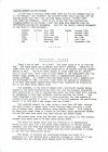
| ImageID: | MIS_1985_017 | | Title: | Mistral. Journal of the Mersea Island Society. January 1985. Page 13.
Local churches. 3. St. Edmund, King and Martyr, East Mersea.
[ author unknown ]
From seawards, the gaunt square tower of St. Edmunds stands stark
above the East Mersea skyline, a dominant and trusty seafarers' landmark.
But perhaps the best way to introduce oneself to this delightful country
church is to cycle from West Mersea or from the Strood across the centre
of the Island, each rise in the road bringing a little more of the tower
into view until,, beside East Mersea Village Shop, Church Lane
appropriately leads to the building itself.
And what a gem it turns out to be.
Like its sister, St. Peter's and Paul at West Mersea, it is difficult to
accurately date the church's foundation or the present building.
Suffice only that it too is ancient and parts of a moat remain which once
enclosed a good five acres including both the church and adjacent East Mersea Hall.
The building has had its fair share of ravages over the centuries, in
clear contrast to the loving care and attention accorded by today's
parishioners. Roundheads billeted there during the Civil War are thought
to have destroyed the rood-screen and stained glass windows.
Moreover, four of the five bells were stolen many years ago, only the
heavy tenor bell - dated 1492 - remaining. Legend has it that the
robbers made off with the bells by sea from a little quay at the foot
of Church Lane, but that the weight of their haul sank their boat
beneath them. Presumably somewhere under Blackwater's mud and silt
four bronze bells await rediscovery.
The tower housing the surviving bell was built in the 15th century and
is scaled from inside the building via an armoured door fitted with
no less than three substantial locks. A beacon was once maintained
atop the tower's little corner turret - a signal for local and national
emergencies - but this has long been removed, probably following damages
sustained during the 1884 earthquake. The three other tower corners
are adorned each by a stone gargoyle - one in the shape of a ram;
another a cow or calf; and the third weathered so much as to be almost
indistinguishable, but thought to resemble a fish. Crosses of flint
in the church's outer masonry indicate major repairs effected over the years.
St. Edmunds has no clock but just to the right of the main door can be
traced the remains of a 'mass-dial' scratched into the stonework
- a sundial which charted the times of services and, inside on the
pulpit, is an old iron hour-glass stand. In case the sermon was
dragging on, despite this advantageously placed reminder that folk
were becoming impatient, a small opening at the side of the pulpit
enabled the parish clerk of years gone by
(I hope it doesn't happen today) to prod the preacher with a
stick'when the occasion demanded.
On the side of the churchyard nearest the Hall is the unusual grave of
15 years old Sarah Wrench who died in 1848 at a time when body-stealing
was possible. To this day Sarah rests in peace, protected by an
impressive iron cage.
Another interesting reminder of those long-since departed this world
is provided by a plaque marking the burial place of Maudlyn Outred
who died in 1572, the wife of the then rector, who marked her passing
with some verse inscribed and legible to this day.
The most famous of East Mersea's clerics, however, was the Reverend
Baring-Gould (1870/81), who wrote the hymn 'Onward Christian Soldiers',
amongst others, and the locally-based novel 'Mehalah'.
St. Edmunds is an attractive English country church - a tranquil haven
admidst the bustle of an East Mersea caravanning summer and, bearing in
mind the small population of that part of the Island, a credit to
the local community.
| | Date: | January 1985 | | Source: | Mersea Museum |
|
 |
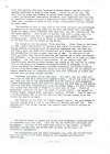
| ImageID: | MIS_1985_023 | | Title: | Mistral. Journal of the Mersea Island Society. January 1985. Page 19.
Laid up tonnage in the Estuary.
At the time of writing, there are only the DELFINI ( ex ALIAKMON RIVER ) and the CAPTAIN JOHN in the river. Movements in 1984 included:
MARTITA arrived June 1984, sailed October 1984
LIANA arrived July 1984, sailed October 1984
SAPELE arrived July 1984, sailed October 1984
POLA arrived February 1984 sailed May 1984
PONZA arrived February 1984, sailed June 1984
ZAK arrived June 1982, sailed September 1984 (for scrapping).
Mersea's Water.
Fancy a cup of tea? Or a bath? The first thing to do is turn the tap. But sixty years ago on Mersea this wasn't possible. There was no piped water and that for household needs had to be carried from the nearest spring or well. The major water supply in those days was St Peter's Well on Coast Road, which today is half hidden in the undergrowth near the Monkey Steps, marked by a manhole cover, a commemorative plaque and a wooden surround. St Peter's Well was never known to fail - despite even the earthquake of 1884, and still today there are springs of freshwater to be seen (and heard) nearby along Coast Road (opposite the houseboats) and on the beach below Meadow Road.
But progress, in the form of piped water, eventually reached Mersea Island in the years following the Great War, and the original waterworks were constructed in 1924 in Uplands Road where the water tower still creates an impressive 72 feet high landmark, visible even from the Strood. This tower comprises a cast-iron tank on brick supports, the tank capable of holding 50,000 gallons of water. (Some of us will remember the scaffolding around it in 1979 when a new copper roof was fitted.)
The borehole beneath the tower sinks no less than 450 feet, through 285 feet of what is termed lower London Tertiary Beds including a thick bed of London clay, before reaching water bearing chalk. This borehole is lined with steel tubes to a depth of 300 feet, being perforated between 242 and 300 feet down where they pass through the Thanet Sands.
The normal water level was 140 feet below ground but when pumping stopped this rose to 60 feet below ground level.
The water was pumped first from the borehole by an electrically driven airlift pump into a low level steel reservoir of 100,000 gallons, and then from this reservoir into the Tower by pumps located on the ground floor. From the Tower tank the water gravitated to houses in the town via distribution mains.
The design of the borehole and associated storage was based on a population of 2,100 persons plus a seasonal increase of 1,000 and it was estimated that the average daily demand would be 50,000 gallons.
Contd on next page MIS_1985_024 . | | Date: | January 1985 | | Source: | Mersea Museum |
|
![Mistral. Journal of the Mersea Island Society. January 1985. Page 20.
Mersea's Water contd.
</p>
<p>
Sterilisation was carried out by the injection of chlorine into the main which discharged into the low-level reservoir but with regard to water quality, a considerable amount of sand was brought up with the water from the borehole. The bulk of this and settled in the low level reservoir from which it was periodically removed. No complaints are known to have been received of turbid or discoloured water but, owing to the high fluoride content, mottled teeth were prevalent amongst children born and brought up in the locality. Furthermore, the water was known to be saline and although residents became used to this it was readily apparent to newcomers and visitors.
</p>
<p>
For more than forty years this system served the island - with just one major scare - in the 1930s when the Tower caught fire! Mersea's firemen responded to the alarm with alacrity only to discover their hoses were too short to reach from the nearest alternative water supply ( appropriately at The Fountain ), to the scene of the fire. Eventually the arrival of more sophisticated equipment from Colchester solved the problem, the fire extinguished, and rather hotter water than usual left to gravitate through the mains.
</p>
<p>Because the population was growing, upon formation of Colchester and District Water Board in 1961, a scheme was prepared to link the supply of Mersea, Salcott, Virley and parts of Wigborough , Langenhoe and Peldon to the Colchester Distribution System, and four years later, in 1965, the new works were inaugurated, catering for an estimated 1981 resident population on Mersea Island of 7,290, 700 in the remaining parishes, with an additional population of 4,000 in caravans. The average daily consumption was forecast to be 440,000 gallons daily with a peak load of 625,000 per day during the summer.
</p>
<p>
The present scheme consists of:-
A 9 diameter main from the Colchester distribution system designed to carry the peak flow of 625,000 gallons per day to:-
A 500,000 gallon two compartment reservoir at Abberton serving:-
by gravity: a 12 to 10 diameter trunk main on to the Island (with a duplicate 10 diameter trunk main laid across the Strood in 1978 to ensure supplied could be maintained in the case of failure of the original main)
and
by pumping: the existing Abberton Water Tower which supplies the surrounding parishes by gravity. [2019: Abberton Water Tower is no longer used and has been sold].
The trunk main from Abberton to Mersea supplies properties en route with a branch main to Peldon, Little Wigborough, Salcott and Virley.
After crossing the Strood this main terminates at Mersea Tower.
</p>
<p>
Surprisingly our Island water does not come from the nearby Abberton Reservoir. That man-made lake is operated by the Essex Water Company and its water fed to the Southend area. Instead our water supply is in the hands of the Anglian Water Authority and comes from Ardleigh Reservoir to the north of Colchester and from deep borehole sources in the River Stour Valley near Nayland.
</p>
<p>And future cuppa's. Well the old Mersea Borehole is still in reserve as an emergency supply but the intention is to increase the supply of water from Ardleigh and the facilities between to cater for our still growing population.
</p>
<p>
Grateful thanks are extended to the Colchester Division of Anglia Water without whose kind assistance this article would not have been possible.
</p>
<p>The author of this article is not given, and was probably William Packard, the Editor of Mistral.
</p><p><b>Read More</b>
Details of the borehole are on the British Geological Survey website - see <a href=http://scans.bgs.ac.uk/sobi_scans/boreholes/557520/images/12169402.html target=bgs>http://scans.bgs.ac.uk/sobi_scans/boreholes/557520/images/12169402.html</a> MIS_1985_024](MMThumbnails22/MIS_1985_024.jpg) |
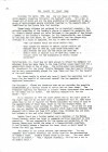
| ImageID: | MIS_1985_024 | | Title: | Mistral. Journal of the Mersea Island Society. January 1985. Page 20.
Mersea's Water contd.
Sterilisation was carried out by the injection of chlorine into the main which discharged into the low-level reservoir but with regard to water quality, a considerable amount of sand was brought up with the water from the borehole. The bulk of this and settled in the low level reservoir from which it was periodically removed. No complaints are known to have been received of turbid or discoloured water but, owing to the high fluoride content, mottled teeth were prevalent amongst children born and brought up in the locality. Furthermore, the water was known to be saline and although residents became used to this it was readily apparent to newcomers and visitors.
For more than forty years this system served the island - with just one major scare - in the 1930s when the Tower caught fire! Mersea's firemen responded to the alarm with alacrity only to discover their hoses were too short to reach from the nearest alternative water supply ( appropriately at "The Fountain" ), to the scene of the fire. Eventually the arrival of more sophisticated equipment from Colchester solved the problem, the fire extinguished, and rather hotter water than usual left to gravitate through the mains.
Because the population was growing, upon formation of Colchester and District Water Board in 1961, a scheme was prepared to link the supply of Mersea, Salcott, Virley and parts of Wigborough , Langenhoe and Peldon to the Colchester Distribution System, and four years later, in 1965, the new works were inaugurated, catering for an estimated 1981 resident population on Mersea Island of 7,290, 700 in the remaining parishes, with an additional population of 4,000 in caravans. The average daily consumption was forecast to be 440,000 gallons daily with a peak load of 625,000 per day during the summer.
The present scheme consists of:-
A 9" diameter main from the Colchester distribution system designed to carry the peak flow of 625,000 gallons per day to:-
A 500,000 gallon two compartment reservoir at Abberton serving:-
by gravity: a 12" to 10" diameter trunk main on to the Island (with a duplicate 10" diameter trunk main laid across the Strood in 1978 to ensure supplied could be maintained in the case of failure of the original main)
and
by pumping: the existing Abberton Water Tower which supplies the surrounding parishes by gravity. [2019: Abberton Water Tower is no longer used and has been sold].
The trunk main from Abberton to Mersea supplies properties en route with a branch main to Peldon, Little Wigborough, Salcott and Virley.
After crossing the Strood this main terminates at Mersea Tower.
Surprisingly our Island water does not come from the nearby Abberton Reservoir. That man-made lake is operated by the Essex Water Company and its water fed to the Southend area. Instead our water supply is in the hands of the Anglian Water Authority and comes from Ardleigh Reservoir to the north of Colchester and from deep borehole sources in the River Stour Valley near Nayland.
And future cuppa's. Well the old Mersea Borehole is still in reserve as an emergency supply but the intention is to increase the supply of water from Ardleigh and the facilities between to cater for our still growing population.
Grateful thanks are extended to the Colchester Division of Anglia Water without whose kind assistance this article would not have been possible.
The author of this article is not given, and was probably William Packard, the Editor of Mistral.
Read More
Details of the borehole are on the British Geological Survey website - see http://scans.bgs.ac.uk/sobi_scans/boreholes/557520/images/12169402.html | | Date: | January 1985 | | Source: | Mersea Museum |
|
 |
| ImageID: | MIS_1985_026 | | Title: | Mistral. Journal of the Mersea Island Society. January 1985. Page 22.
Hedgerows contd.
Public houses on Mersea. Fox and White Hart under new management. The host of the White Hart is moving to the Plough in Peldon. The Peldon Rose is still up for sale - at £250,000 or thereabouts.
Restaurants - the Willows burnt down and the Hall Barn closed. | | Date: | January 1985 | | Source: | Mersea Museum |
|
 |
| ImageID: | MIS_1985_032 | | Title: | Mistral. Journal of the Mersea Island Society. January 1985. Page 28.
The Plaque in Coast Road.
7 April 1984 the Society unveilled a plaque on Coast Road:
The Old Cricket Field and St Peter's Well
This plaque was erected by the Mersea Island Society and records that in 1975 Mr Alec Grant registered the area between the road and the beach and from the Monkey Steps at Orleans Wall to Hove Hill Creek as a Village Green for the Recreation of Mersea Island residents.
| | Date: | January 1985 | | Source: | Mersea Museum |
| |