
121. Jack Botham aerial photograph 3309. Junction of High Street North and Upland Road, which is continued as a bridle way to the bottom right hand corner. The ...
Date: c1962
Image ID JBA_556 |

122. Jack Botham aerial photograph 3309. High Street North with Upland Road going off towards upper left. Sam Webb's bungalow on Upland Road and his field behind it ...
Date: c1962
Image ID JBA_560 |
![123. ID JBA_562 Jack Botham aerial photograph 3310. Upland Road, water tower. The large tank behind the tower was built but never used [RG]. The entrance to Reymead Close was ... 123. ID JBA_562 Jack Botham aerial photograph 3310. Upland Road, water tower. The large tank behind the tower was built but never used [RG]. The entrance to Reymead Close was ...
Cat1 Aerial Views-->Mersea](MMImages5/JBA_562.jpg)
123. Jack Botham aerial photograph 3310. Upland Road, water tower. The large tank behind the tower was built but never used [RG]. The entrance to Reymead Close was ...
Date: c1962
Image ID JBA_562 |

124. Jack Botham aerial photograph 3311. Upland Road. Queens Corner top left.
Date: c1962
Image ID JBA_564 |
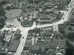
125. Jack Botham aerial photograph 9220. View looking south - Mill Road lower left and Kingsland Road upper right. Fountain Hotel with the dance hall to the right of ...
Date: c1962
Image ID JBA_576 |
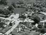
126. Jack Botham aerial photograph 3315. Fountain Hotel with dance hall and Queens Corner.
Date: c1962
Image ID JBA_577 |

127. Windsor Road junction with East Road. Windsor Road later became Oakwood Avenue, and from 1971 Oakwood Avenue was continued in stages to the south.
Jack ...
Date: c1962
Image ID JBA_580_001 |

128. Jack Botham aerial photograph 630. East Road on right and its junction with Windsor Road, later to become Oakwood Avenue.
Date: c1962
Image ID JBA_584 |

129. Jack Botham aerial photograph 9131A. East Road across top, Oakwood Avenue and Windsor Road to centre right.
Date: c1962
Image ID JBA_586 |

130. Jack Botham aerial photograph 631. Windsor Road (later Oakwood Avenue) across bottom, East Road on the right. Norfolk Avenue and Suffolk Avenue.
Date: c1962
Image ID JBA_590 |

131. Jack Botham aerial photograph 3319. East Road and corner of Seaview Avenue. Assembly Hall.
Date: c1962
Image ID JBA_596 |

132. Jack Botham aerial photograph 1712. Brierley Avenue. East Road across top left corner.
Date: c1962
Image ID JBA_598 |

133. Jack Botham aerial photograph 633. East Road upper left to centre right. Dawes Lane from centre left with the Blackwater Terrace Council Houses prominent. Cross ...
Date: c1962
Image ID JBA_600 |

134. Jack Botham aerial photograph 634. East Road across the picture - the Fox near the centre.
Date: c1962
Image ID JBA_602 |

135. Jack Botham aerial photograph 3320. East Road and the Fox on the left.
Date: c1962
Image ID JBA_604 |

136. Jack Botham aerial photograph 2220. East Road with the Fox near the centre. The Fox still has the hall on its eastern side. Brierley Hall and barn top right.
Date: c1962
Image ID JBA_608 |

137. Jack Botham aerial photograph 2221. View southwest to River Blackwater. Seaview Holiday Park on the left and Cross Lane centre left down to bottom right.
Date: c1962
Image ID JBA_640 |
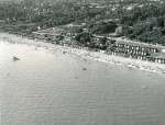
138. Jack Botham aerial photograph 2126A. Victoria Esplanade, Broomhills Road, Spinney Cafe.
Date: c1962
Image ID JBA_650 |
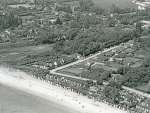
139. Jack Botham aerial photograph 3212. Victoria Esplanade, Broomhills Road, Spinney Cafe. Boating Lake on the left.
Date: c1962
Image ID JBA_654 |

140. Jack Botham aerial photograph 3213. Boating Lake in centre with Lower Kingsland Road beyond. Corner of Broomhills Road and Victoria Esplanade on right.
Date: 2 June 1963
Image ID JBA_658 |

141. Jack Botham aerial photograph 635. The Strood, mainland end, looking north. The water to the east of the road is thought to be the leat or reservoir for the ...
Date: c1962
Image ID JBA_812 |

142. Jack Botham aerial photograph 600. Laid up ships in River Blackwater with Bradwell Power Station under construction beyond. The tanker in the foreground is ...
Date: 4 September 1960
Image ID JBA_905 |

143. Jack Botham aerial photograph 2114A. Bradwell Power Station and baffle wall under construction. Laid up Shell tanker.
Date: 23 August 1959
Image ID JBA_906 |

144. Aerial view of West Mersea. Firs Road and High Street North on left. Barfield Road, Kingsland Road, Queens Corner, Colchester Road, East Road.
Date: 1955
Image ID JP01_007 |

145. Aerial survey of the area around the fort at East Mersea.
The red arrows on the shore point to rows of stakes - origin not yet known. Fish traps or fish weirs ...
Date: 2014
Image ID JPL_001 |

146. Survey map of area around the fort at East Mersea.
Copyright James Pullen
Date: 2014
Image ID JPL_003 |

147. The large Red Hill on the north side of Mersea Island, east of the Strood. Google maps places this at 51 48'04.5N and 0 55'55.3E. The image here is a simple ...
Date: c2014
Image ID JPL_005 |

148. Mersea History Walk 10.
Church, Church Road and Churchfields - aerial view. Photograph taken by Mike from a private plane, on a flight primarily to ...
Date: Before 2003
Image ID MLD_HWK_011 |
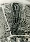
149. Boating Lake aerial view, with north at the top. Broomhills Road is along left side and Prince Albert Road is across the top. Only one house is on east side of ...
Date: 1940s
Image ID MLD_LAK_165 |

150. West Mersea aerial view, Coast Road with St Peter's Road across the bottom of the photograph.
Image ID MSP_AER_003 |