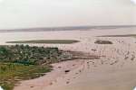
1. The Hard, Cobmarsh and Packing Marsh Islands. Bradwell in the distance.
Date: c1981
Image ID DC3_002 |

2. The Hard looking northeast towards the Strood. Packing Marsh Island and Cobmarsh Island on the right.
Date: c1981
Image ID DC3_003 |

3. Looking towards the Hard and Mersea Island. Packing Marsh Island centre.
Date: c1981
Image ID DC3_004 |

4. Buzz'n Creek. Houseboats and the Hard beyond.
Date: c1981
Image ID DC3_005 |

5. The Hard, Coast Road car park, causeway, Clarke & Carter's slipway. Hulk of PIONEER top right.
Date: c1981
Image ID DC3_006 |

6. The Hard, causeway on the left. West Mersea Yacht Club in the centre.
Date: c1981
Image ID DC3_008 |
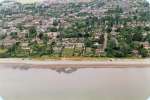
7. New Orleans on the left, Beach Road towards the right.
Date: c1981
Image ID DC3_009 |

8. Broomhills Road - Victoria Esplanade. Western end of the beach huts. Cobmarsh on the corner of Willoughby Avenue and Five Gables behind it set back from the ...
Date: c1981
Image ID DC3_010 |
![9. ID DC3_011 View looking north of part of Victoria Esplanade, West Mersea. Two Sugars Cafe - Gun No.1 emplacement [MCC7269] to the west of it appears to have been recently ... 9. ID DC3_011 View looking north of part of Victoria Esplanade, West Mersea. Two Sugars Cafe - Gun No.1 emplacement [MCC7269] to the west of it appears to have been recently ...
Cat1 Aerial Views-->Mersea Cat2 Mersea-->Beach](MMThumbnails8/DC3_011.jpg)
9. View looking north of part of Victoria Esplanade, West Mersea. Two Sugars Cafe - Gun No.1 emplacement [MCC7269] to the west of it appears to have been recently ...
Date: c1981
Image ID DC3_011 |

10. Seaview Avenue. Charleston Court in the centre.
Date: c1981
Image ID DC3_012 |
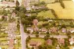
11. Seaview Avenue - East Road junction, looking east. Assembly Hall bottom centre.
Date: c1981
Image ID DC3_013 |
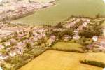
12. Seaview Avenue lower left and East Road across the centre. Looking northwest.
Date: c1981
Image ID DC3_014 |

13. Mersea Island looking west from Wellhouse Farm.
Date: c1981
Image ID DC3_015 |

14. Looking south with East Road across the centre and Seaview Avenue going down to the beach.
Date: c1981
Image ID DC3_016 |
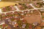
15. Looking north with Whittaker Way across top half of picture.
Date: c1981
Image ID DC3_017 |

16. Looking south with Whittaker Way across the picture and Buxey Close lower centre.
Date: c1981
Image ID DC3_018 |
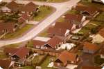
17. Looking northeast with Whittaker Way centre left to top right and Gunfleet Close top left.
Date: c1981
Image ID DC3_019 |

18. Looking east with Whittaker Way up the centre.
Date: c1981
Image ID DC3_020 |
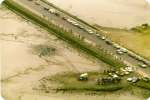
19. Young Farmers - playing on the mud at the Strood. Old barge dock lower centre.
Date: c1981
Image ID DC3_021 |
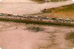
20. Young Farmers - playing on the mud at the Strood.
Date: c1981
Image ID DC3_022 |
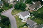
21. View looking northeast where Firs Hamlet from bottom meets Firs Chase.
Date: c1981
Image ID DC3_023 |
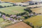
22. East Mersea looking southeast, with East Road going up from centre to left and North Farm Lane from centre to bottom left (to Colchester Oyster Fishery).
Date: c1981
Image ID DC3_026 | | |